 SULAYR TRAIL GR-240
 SULAYR TRAIL GR-240
The largest circular trail in Andalusian and Spanish geography.
Discover the unique Penibetic landscapes through a personal experience influenced by the contact with nature.
19 tracks to enjoy walking in Sierra Nevada.
 GREEN PATHS
 GREEN PATHS
Path Güejar-Sierra – San Juan´s Ravine.
Continuous platform . 6 km , 4 bridges , 6 tunnels www.viasverdes.com
EL TREVENQUE TRAIL
Time: 3 hours
Difficulty: Average- Distance: 4 km approx.
Leaving the Cortijo Balzain we passed the Fuente of the Hervidero and arrived at the Cortijo Sevilla (2 km. approx.)
. Up to here we can do it in car and park it next to the Canal of the Espartera.
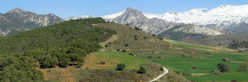
We undertake the ascent with wich the footpath begins that follows the cord of the Trevenque.Throughout the way we are going to front have a sight of high summits, and to the right the Alayos.
 Passed one hour and average, we arrived at numerous points from wich we can appreciate an incredible landscape: From the high summits, to our right, the Alayos, to our back the Vega of Granada and to our left, the Valle of Huenes crowned of the west to this by the Carne peak, the Cocón peak and the Tesoro peak, in the skirt of wich is the Botanic Garden of La Cortijuela, good sample of the mediterranean vegetation. From this place it is easy that we are able to see wild goats, wild boards and birds of prey that grazes in the fields in the zone.
We continued way, 15 minutes, until a point in wich the itinerary contacts with the track, place where we can observe the terraces of reforestation of the pine groves, as well as the great erosion of this surroundings.
From here, we went to the Trevenque by the track, aother one half an hour; if we want to raise we will add one hour to the itinerary to enjoy it to the maximum, since we wee in one of the maximum, since we were in one of the zones of greater value of the National Park, with infinity of endemic species, that is to say, exclusive own of dolomías, mainly flora. For that reason we must display a special respect.
For the return we will return by the track that already we took, until arriving again at the Cortijo Sevilla, in wich we will take 45 minutes approximately.
DE LA ESTRELLA TRAIL
Time: 3- 3:30 hours roundtrip
Difficulty: Low – Distance: 6 km approx.
Leaving by car from the Cortijo Balzaín we drive to the village of Güejar-Sierra (15 km. approx.). It is necessary to go towards the restaurant at the confluence of the Genil river with the Arroyo de San Juan. Here is recommended to leave the car and to follow by foot the footpath that runs by old road by where it lowered with oxen the gone away materials of the mines. The route ascends by forest of quejigos, servales, maples, from where the Genil river is seen. .
In the union of the rivers Genil and Vadillo it’s observed in the slope of opposite, the Cuesta of the Presidarios. By this tortuous way one took to the condemned prisoners to galeras tied with shackles from Granada to Almería.
The route follows in ascent until arriving at the Cueva Secreta at 1.735m. of altitude. the place by natural shelters protected by walls, old refuges of shepherds is recognized and manzanilleros. If you animate yourself and you are not very demanding, you even can spend the night in these shelters.

